
Devon Falls: The Veil of the Valley
Easy · Nuwara Eliya District · Central Province
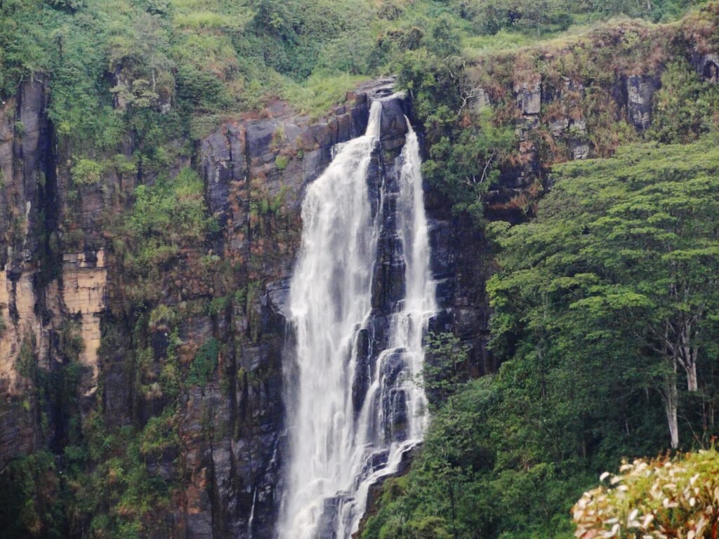
Devon Falls, nicknamed the "Veil of the Valley", drops 97 m in three tiers about 6 km west of Talawakele. It is named after Devon, an English coffee planter whose estate lay nearby.
What you’ll walk through
The falls are seen from the A7 highway, at about 1,140 m above sea level, on a tributary of the Kotmale Oya. Paired with St. Clair's Falls a few kilometres away, it makes an easy hill-country stop by road or rail. We have not found a reliable description of a path to the base.
Watch for traffic at the roadside viewpoint.
Access & permits
Viewed from the roadside. We could not confirm any access rules or fee.
On the map
Pin 1 is Devon Falls. The others are the nearest places in our trail directory.
- Devon Falls: Seen from the A7 near Talawakele.
- St. Clair's Falls: Twin falls near Talawakele. About 2 km away.
- Great Western Mountain: Summit, 2,216 m, above Great Western station. About 7 km away.
- Galboda Falls: A 2 km walk from Galboda station. About 10 km away.
Key landmarks & features
- A7 highway - The road the falls are seen from.
- Three tiers - A 97 m drop in three stages.
- Talawakele - The town about 6 km east.
- St. Clair's Falls - The neighbouring falls on the Kotmale Oya.
When to go
Any clear daylight stop; the flow is strongest in the wet months.
Walk it with Hike Lanka
You can take this as a guided day trip, link it with nearby destinations into a multi-day trek, or build it into a custom Sri Lanka hiking itinerary. We handle transport, permits and the logistics; you walk.
Nearby in the directory
Walk this trail with us
Join a guided day hike, plan a multi-day itinerary, or ask us anything about Sri Lankan trekking. A real guide responds to every enquiry.
Browse Guided TreksPlan a Custom Route